


Today's rain chance is the lowest of the week
Plus: Summer nights are getting warmer

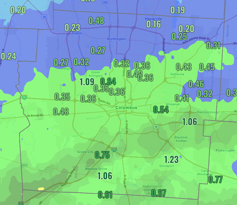
Yesterday morning’s rain was another decent soaker with the southern half of the metro getting over a third of an inch and a narrow band picking up a closer to an inch.
The 614cast
Tuesday tl;dr
🫠 Humid with highs near 90. Mostly sunny, isolated afternoon storm possible.

Forecast highlights
🌦️ Unsettled weather, for the most part
As noted yesterday, a front is draped across the region and is in no hurry to get out of here. Because of that, our weather will be somewhat unsettled this week with off-and-on rain chances.
However, there’s not much going on to kick off showers or storms today, so whatever might develop this afternoon looks very sparse.
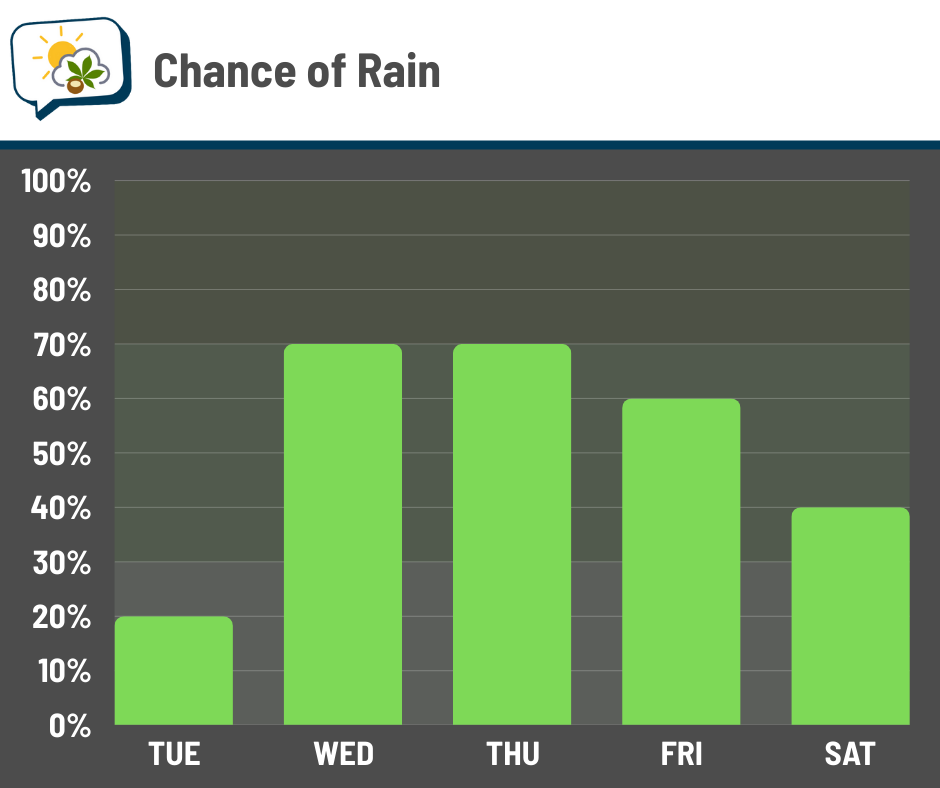
Starting tomorrow, though, little ripples of energy should pass by and tap into the warmth and humidity, producing more activity. You can see the increased coverage/likelihood of rain in this blended model forecast:
Severe thunderstorms remain unlikely, but there’s an outside chance of a couple storms producing sub-severe wind gusts. Local downpours and perhaps some minor nuisance flooding are still the main thing to watch for, as has been the case lately.
💦 Muggy weather stays around
Wouldn’t it be nice to walk outside and have it not be humid?

Yeah, not happening anytime soon.
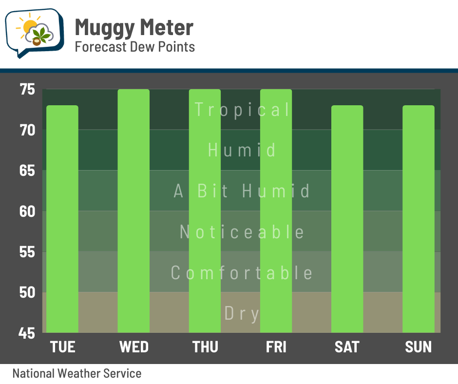
Dew points will be in tropical levels just about all day through the weekend. There are some signs they could dip slightly early next week, but rise right back up thereafter. So, if you’re looking for a break from the humidity, you’ll have to leave central Ohio. That said, winds on Wednesday and Thursday afternoon should be around 10–15 mph, making the gross weather feel ever-so-slightly less gross.
I’ve previously talked about the unusually muggy year we’ve been having, and here’s another look at it. This plot shows the number of hours with a given dew point so far in 2025 (red dots) compared to average (blue dots). The black lines connecting them are just to make the chart a little easier to read.

We’ve had many more hours of elevated dew points than average… for example, 2025 has had over 300 hours with dew points of at least 70. The average through July 14 is about 113 hours.
📊 Today’s almanac
Normal low/high: 66 / 86
Record low/high: 49 (1930) / 100 (1988)
Sunrise/set: 6:16 a.m. / 8:59 p.m.
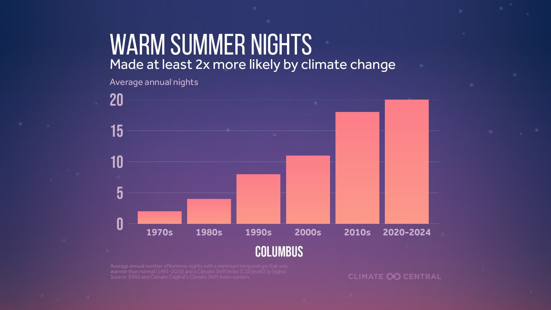
🌃 Summer nights are getting warmer
The average summertime morning low Columbus have warmed more than four degrees since 1970, according to analysis from Climate Central.
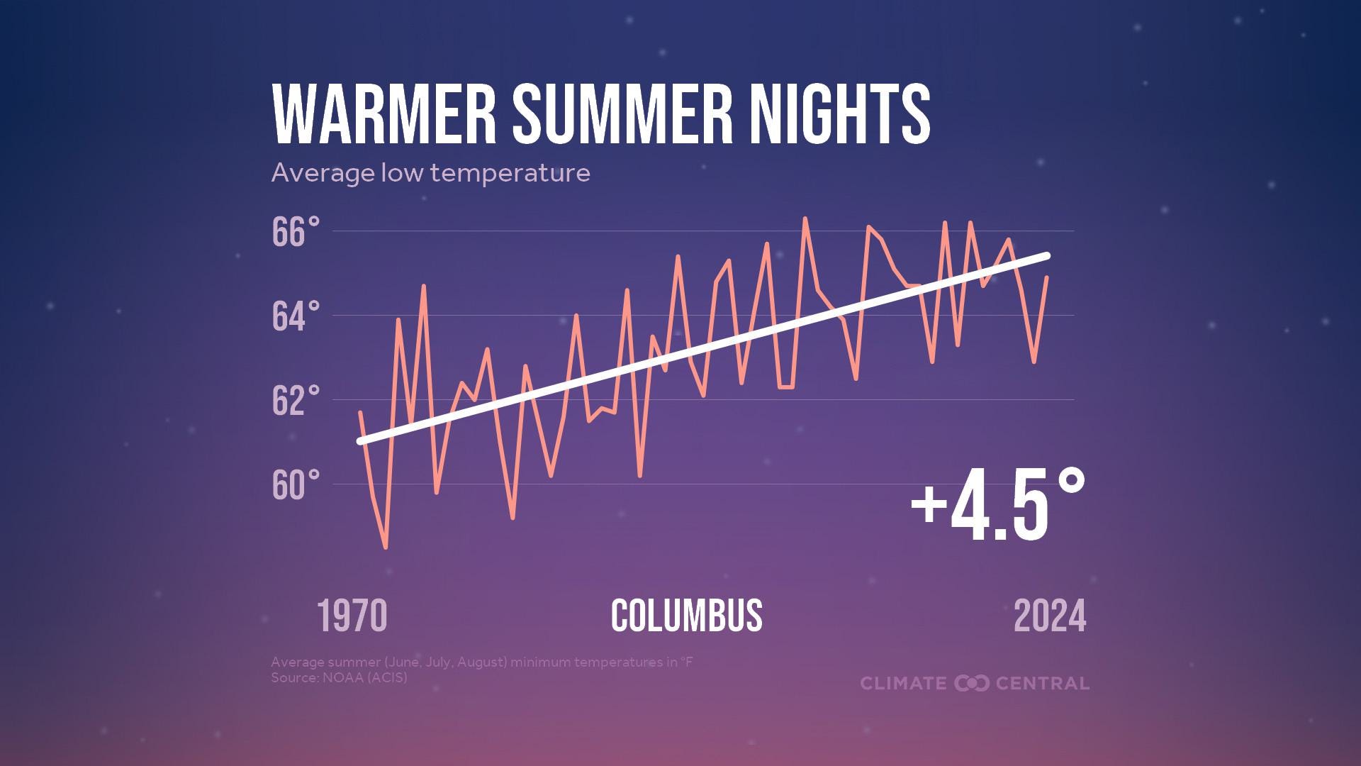
Columbus surpasses the national average increase in summer nighttime lows, which was just over three degrees since 1970.
Climate Central’s “Climate Shift Index,” which assesses climate change’s influence on daily temperatures, shows that we now have about 20 nights each summer that are strongly influenced by climate change.
Hot days, of course, cause health concerns. But warm nights do, too, particularly when you have back-to-back warm days and warm nights. From Climate Central:
Sweltering nights limit our ability to cool off and recover from hot summer days. This can lead to greater heat stress and related health risks — especially among people with chronic illness, young children, pregnant people, the elderly, weather-exposed workers, and other heat-vulnerable populations.
Structural inequities can lead to higher urban heat exposure for some communities. According to a 2021 study, people of color and those living below the poverty line are disproportionately exposed to urban heat extremes in 169 of the largest U.S. cities.
“It’s summer” is simply not a productive response to heat. It has real consequences that often don’t grab the same attention as things like hurricanes or tornadoes or blizzards. Heat issues are often a slow burn and contribute to hundreds, if not thousands, of deaths in the U.S. each year.
🌭 Bonus weather weenie content
Coroner: 36-year-old man dies after being struck by lightning at north Columbus high school (10TV)
Hearing on weather forecasting follows Texas floods (E&E News)